Welcome to
ANEKA GPS ( Gunapris Group) 021-99952977 / / 08179123511 AGEN GPS GARMIN, GPS MAGELLAN, GPS TRIMBLE, NIKON, TOPCON, SOKKIA, HORIZON, EPOCH, MOTOROLA, ALINCO, iCOM, SAMYUNG, SUUNTO, BRUNTON, LEICA, ALAT SURVEY, ALAT GEOLOGI

Free Member
ANEKA GPS ( Gunapris Group) 021-99952977 / / 08179123511 AGEN GPS GARMIN,  GPS MAGELLAN,  GPS TRIMBLE,  NIKON,  TOPCON,  SOKKIA,  HORIZON,  EPOCH,  MOTOROLA,  ALINCO,  iCOM,  SAMYUNG,  SUUNTO,  BRUNTON,  LEICA,  ALAT SURVEY,  ALAT GEOLOGI
ANEKA GPS ( Gunapris Group) 021-99952977 / / 08179123511 AGEN GPS GARMIN, GPS MAGELLAN, GPS TRIMBLE, NIKON, TOPCON, SOKKIA, HORIZON, EPOCH, MOTOROLA, ALINCO, iCOM, SAMYUNG, SUUNTO, BRUNTON, LEICA, ALAT SURVEY, ALAT GEOLOGI
Indonesia
  • Sell

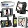
    GARMIN GPSMAP 296C (Aviation)

    Price:
    CALL 021-99952977 or SMS 08179123511
    Quantity Order:
    Origin:
    Taiwan
    Payment Method:
    Telegraphic Transfer (T/T), Cashier Order
    Quantity:
    Ready Stock
    Pack. & Delivery:
    BARU & GARANSI
    Physical & Performance:
    Unit dimensions, WxHxD: 5.7"W x 3.2"H x 1.9"D (14.5 x 8.1 x 4.8 cm)
    Display size, WxH: 3.2"W x 2.1"H (8.1 x 5.3 cm); 3.8" diag (9.7 cm)
    Display resolution, WxH: 480 x 320 pixels
    Display type: 256 color TFT with backlighting
    Weight: 13.6 ounces (385.5 g)
    Battery: rechargeable lithium-ion
    Battery life: up to 15 hours (Battery Saver mode, no backlighting)
    Voltage range: 11-40
    Receiver: 12 channel
    IFR or VFR: VFR
    Maps, Databases & Memory:
    Basemap: yes
    U.S. Terrain and Obstacles database: yes
    Jeppesen® database: yes
    Types of Jeppesen databases: full and ARTCC, FSS frequencies and final approach waypoints
    Jeppesen database coverage areas: Americas, Atlantic International or Pacific International
    SafeTaxiâ„¢ airport diagrams: no
    AOPA Airport Directory: no
    Preloaded maps: no
    Ability to add maps: yes
    Accepts data cards: yes (Garmin data cards)
    Built-in memory: internal solid state
    Waypoints/favorites/locations: 3,000
    Routes: 50
    Features:
    Moving map: yes
    Instruments page: yes
    Built-in VHF Comm: no
    External VHF Comm: no
    Built-in HSI: yes
    Traffic Information Services (TIS) alerts compatible: no
    Audible terrain alerts: no
    Smart Airspace Feature (generates and displays altitude-sensitive alerts): no
    Separate serial and USB interfaces: yes
    Automatic logbook: yes
    Voice prompts (e.g. "Turn right in 500 ft."): yes
    3-D map view: no
    Auto sort multiple destinations (provides most direct route): no
    Auto re-route (fast off-route and detour recalculation): yes
    Choice of route setup (faster time, shorter distance, off road): yes
    Route avoidance (avoid highways, tolls etc.): yes
    Custom POIs (ability to add additional points of interest): no
    XM WX Weather & Radio for U.S. compatible: no
    Automotive-friendly: yes

    Taking terrain awareness to a whole new level, the GPSMAP 296 is a color aviation portable with built-in terrain mapping and alerting.
    Enhance Situational Awareness

    GPSMAP 296 comes with a detailed built-in Jeppesen® database along with terrain and U.S. obstacle databases. Using this information, the 296 provides detailed views of your flight route, displayed over realistic topography. For added safety, you can put the unit in Terrain mode for TAWS-like warnings and alerts when proximity conflicts loom ahead.
    View Images in Sharp Detail

    Viewing the display in any light is easy, thanks to the unit’s 256-color, high-resolution (320 x 480-pixel) sunlight-readable TFT display with adjustable backlighting. The 296 also features USB data transfer, fast processing speed and a rechargeable lithium-ion battery pack.
    Automate Your Logbook

    A built-in logbook tracks your flying hours and automatically records departure and arrival locations. When used with Garmin's free logbook software, FlightBook, this feature simplifies recordkeeping. Flightbook software allows you to create, manage, analyze, save and print flight data from the GPSMAP 296's logbook.
    Navigate by Air, Land or Sea

    Simply press a button to switch GPSMAP 296 to automotive or marine mode. The 296 comes with a built-in routable basemap. Add optional MapSource® detailed street maps to receive voice-prompted turn-by-turn directions to addresses and points of interest. For a great day on the water, customize the waterproof 296 with optional marine cartography. Easily add detailed maps with plug and play Garmin data cards.

    GPSMAP 296: Go from plane to boat to automobile without missing a beat.


You have [3] new inquiries.
Go to Member Menu

Home - Trade List - Product List - Inquiry List - Cooperation List - Company List
Copyright © 2024 Indomonster.com. All Rights Reserved.